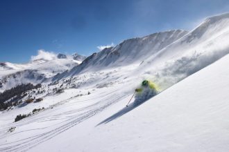
Is it starting to feel a lot like Christmas? Your weather app might disagree.
Even in Colorado’s High Country, an unusually warm December is sparking concerns that a white Christmas may not happen this year.
Temperatures in central mountain valleys have been running about 15 to 25 degrees above normal, according to National Weather Service meteorologist Bruno Rodriguez.
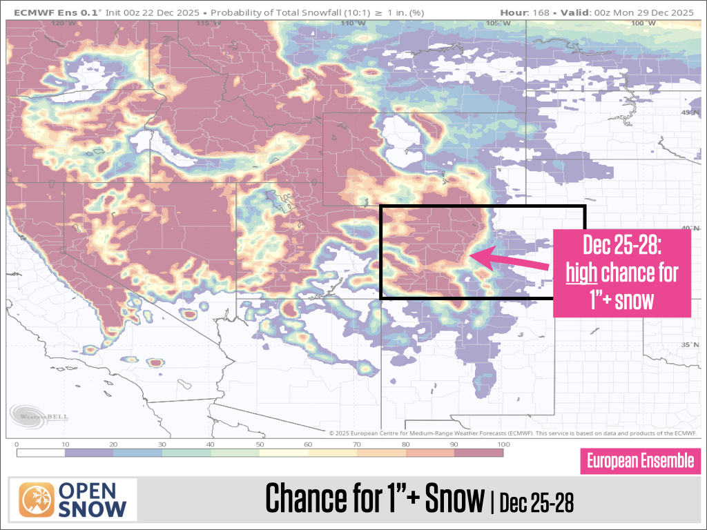
Forecasters say there is a small chance for snow before Christmas Day ends on Thursday, particularly in the northern and southern mountain regions. However, most of the precipitation is expected to arrive between Friday and Saturday.
“We still have a little bit of a stretch here of pretty mild and dry conditions, really through late Christmas,” Rodriguez said.
Daytime highs in mountain areas could reach above 50 degrees through Christmas Day, with temperatures possibly dipping into the 40s on the holiday itself. Snow could start as early as Thursday afternoon, though recent forecasts suggest it may not arrive until later in the evening.
A storm system is expected to move into the mountains from the southwest, a setup Rodriguez noted is typically less favorable for the central mountains along the Interstate 70 corridor. Those areas may see totals of 2 to 5 inches by Saturday, while the northern mountains, including the Park and Gore Ranges, could receive 6 to 12 inches.
The southern Rockies, including the San Juan Range, are also expected to be favored for higher snowfall during that period.
Joel Gratz, a meteorologist who runs the online blog OpenSnow, said the chance for at least 1 inch of snowfall between Thursday and Sunday is “high at all mountains.” Chances for 6 or more inches are higher for the southern and west-central mountains due to favorable wind direction from the southwest, and lower for most other areas.
“It’s going to snow,” Gratz wrote in a Monday blog post.
Looking ahead, Colorado’s High Country could face another dry stretch lasting at least until New Year’s.
Rodriguez said more active weather patterns are expected to return after Dec. 31, while Gratz noted that from Jan. 1–5, “There’s a signal for all mountains (northern, central, southern) that another storm could bring snow,” though the data still points to an uncertain outlook.
The variable weather through early January may offer little relief for the state’s ski areas, which are already dealing with a limited snowpack.
Gratz said that, by percentage, minimal terrain is open at most ski areas, with Wolf Creek, Monarch and Ski Cooper reporting the most terrain available.
For the holiday period through Jan. 4, “it is unfortunately likely that limited terrain will be open at most mountains,” though Gratz added that snowfall from Dec. 25–28 “could decently expand terrain in some areas.”
Colorado snowpack levels are approaching historic lows.
Statewide snowpack measured just over half of the 30-year median — 57% — as of Monday, coming close to what is considered the historic minimum, according to data from the Natural Resources Conservation Service.
Still, much of the season remains. Snowpack across the state typically peaks on April 8, which is more than 100 days away.
Looking at previous seasons that started with low December snowpack, Gratz predicts there is a 50-50 chance that Colorado either finishes with below-average snowpack or rebounds to meet — or even exceed — the average.
Climate impact
Colorado is not alone in experiencing warmer holiday temperatures.
An analysis from the nonprofit news organization Climate Central found that Christmas temperatures across the U.S. are expected to run between 20 and 35 degrees above average — increases the group says are at least two to three times more likely because of human-caused carbon pollution.
The nonprofit produces those estimates using its Climate Shift Index, which maps the influence of climate change worldwide. The index compares today’s climate to models of a world without human-driven climate influence to determine how much more frequently extreme heat occurs compared to a scenario without greenhouse gas pollution.